- LOCATION:
- Massie Township
- Harveysburg Rd.
- Harveysburg, Ohio 45032
Hatton Lukens Park is approximately 1/2 mile from Caesars Creek Lake in the northeastern section of Warren County. Located on E. Rt. 73 at the Village of Harveysburg. 5 miles from Waynesville - 3 miles to I-71. The park is located approximately 12 miles west of Wilmington, Ohio and near Clinton Massie schools.
HISTORY
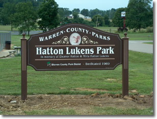
On November 5, 1974 Miriam Lukens and William A. Lukens conveyed 35 acres of land as a memorial gift in memory of Eleanor Hatton, sister of Miriam Hatton Lukens. The land was to be used exclusively for a bird/wildlife refuge wilderness area and wild flower sanctuary. In 1989 the wildlife sanctuary was traded back to Miriam Lukens for 35 acres of real estate on Harveysburg Road in the Village of Harveysburg for the purpose of a Warren County Park.
An 80-foot wide roadway easement was granted to Peter Carroll for the purpose of an exit from the Renaissance Festival. Mr Carroll entered into an agreement to pay the real estate taxes each year on the Hatton Lukens Park. This is a permanent agreement.
Phase I development began with the development of a 10 acre tract of land, consisting of 1 baseball field, 2 soccer fields, split rail fence, roadway and parking lot. Phase I cast $89,000. In 1993 a picnic shelter and basketball court was constructed. In 1995 a second shelter and playground was added. In 1996 a fenced-in double horseshoe court was constructed. In 1997 a sand volleyball court was constructed, and in the year 2000 a roadway and parking lot was developed to the rear of the park. Since that time field use and development have been ongoing and use is intense.
| TOTAL ACREAGE: |
35 acres |
| WOODED ACREAGE: |
Approximately 2.50 acres |
DESCRIPTION
The Hatton Lukens Park is primarily a sport complex located on 35.515 acres. The park has a small stream running through the southwest section of the park. Most of the land is generally rolling terrain. Wild turkeys, deer and other wildlife are often seen in the early morning and late evening. The park backs up to the Caesar Creek State Park and provides parking and access to the Caesar Creek mountain bike and trail complex.
GEOLOGICAL TOPOGRAPHICAL AND GEOGRAPHICAL CHARACTERISTICS
There are three types of soil found in this park, Fincastle, Brookston and Russell. The Fincastle soil is used for field crops commonly grown and typically occurs on uplands. Brookston series soil has very dark, silty clay loam surface, layers are about 12 inches thick, and again this type of soil is used for farming. The Russell series is dark grayish-brown silt loam about 7 inches thick, well suited to cultivate crops. The park is generally rolling, located in the northeastern section of Warren County with run off going into Caesars Creek Lake.
PRESENT USES
Sport Fields and Picnicking